There's a version of the Blue Ridge Parkway that most photographers encounter — the one on Pinterest, the one with the lone tree silhouetted at golden hour, the one that looks like it required nothing more than showing up. After years of shooting this road in every season and every kind of light, I can tell you that version is real, but it's selective. Within 90 minutes of Asheville, the Parkway offers some of the most rewarding landscape photography in the Southeast, and it will also hand you flat, crowded, compositionally frustrating mornings if you don't know what you're working with.
This guide covers the overlooks and trailheads I actually return to — north and south of Asheville — with honest assessments of what each one offers, when to go, and what to watch out for. I'm a Western North Carolina-based landscape photographer, and this stretch of road is essentially my backyard. I've shot it in June fog, October crowds, January ice, and every possible permutation of morning light. What follows is what I've actually learned.
Before You Go: A Few Things Worth Knowing
The Parkway's northern section is currently closed. As of 2025, the Blue Ridge Parkway north of roughly the Ridge Junction Overlook area remains closed due to damage from Hurricane Helene. This is not a minor detour situation — significant sections of road and infrastructure were affected. Check the National Park Service Blue Ridge Parkway’s current conditions page for the most up-to-date closure information before planning any trip north of Asheville. Updates on full reopening are expected, with some sections anticipated to reopen in 2027.
Light moves faster than you think. The Parkway's elevation and orientation mean golden hour is genuinely golden — and genuinely brief. If you're planning a sunrise shoot, arrive 30 to 45 minutes before the stated sunrise time. The best light often comes in the 15 to 20 minutes before the sun clears the ridgeline, when the sky is soft and the shadows are long. Miss that window and you're shooting in flat, rising light.
Use a planning app before you go. The Blue Ridge Parkway curves and winds enough that the sun's position relative to any given overlook shifts significantly throughout the year. An overlook that faces directly into a June sunrise might catch nothing but side light in October. The Photographer's Ephemeris is the tool I reach for — you can drop a pin at any location and see exactly where the sun rises and sets on any date, including whether the light will actually clear the ridgeline before it moves off your subject. Golden Hour and PhotoPills are solid alternatives. A few minutes of planning before you leave the house saves a lot of cold, dark disappointment on the mountain.
Temperature drops with elevation. What's 65°F in Asheville can be 50°F or colder on the ridge, and that gap widens in shoulder seasons and winter. Dress in layers, bring an extra battery or two (cold kills batteries faster than anything), and keep a microfiber cloth in your pocket for condensation on your lens when you move between temperature zones.
Weekday mornings in the shoulder season are your best bet for solitude. Peak foliage in October and summer weekends bring real crowds to the most popular overlooks. If your schedule allows any flexibility, a Tuesday morning in late May or early September is a different experience entirely.
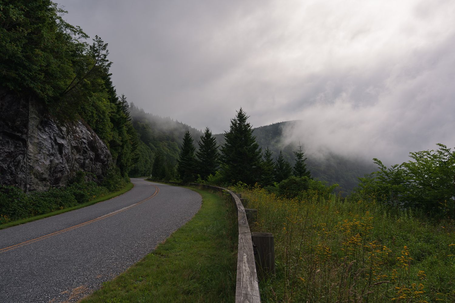
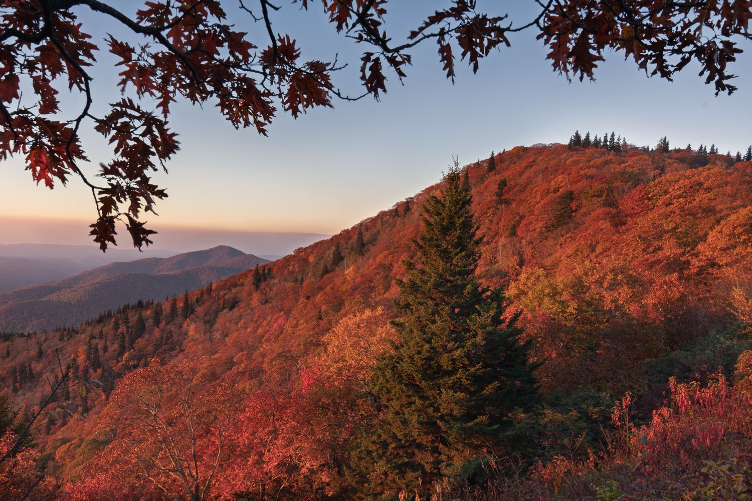
Blue Ridge Parkway after a late summer storm
North of Asheville
Craggy Overlook: Easy Access, Big Views, Real Crowds
Craggy Overlook sits roughly 18 miles north of Asheville at Milepost 364.4 and is one of the most accessible sunrise and sunset locations on this entire stretch of road. The parking area is ample, the elevation is significant without requiring a serious hike, and the views open in both directions — east toward the rising sun, west for evening alpenglow. I've shot here dozens of times and I'll keep coming back.
That accessibility is also its limitation. On peak foliage weekends and summer Saturdays, you'll share this spot with a lot of people. That's not a dealbreaker, but it's worth factoring into your planning. A weekday in May or September changes the experience considerably.
Two things make Craggy worth more than a single visit. First, the hike to Craggy Pinnacle (about 0.7 miles from the Craggy Gardens Visitor Center parking area) rewards you with longer-range views and leads to what locals call the Craggy tree — a windswept, solitary hawthorn that has appeared in more Blue Ridge photographs than I can count. It's iconic for good reason. The composition works because the tree is genuinely beautiful and strange-looking, and the background earns it.
Second, don't spend your whole time at the main overlook. Walk across the road. In summer and early fall, wildflowers line the roadside on the opposite side, and you'll often find foreground opportunities that most photographers drive right past.
Best for: Sunrise, sunset, accessible elevation, summer wildflowers, Craggy Pinnacle hike
Crowd level: High on weekends and peak season; manageable on weekday mornings
Distance from Asheville: About 30 minutes
Mount Mitchell: Worth the Wait for the Right Conditions
Mount Mitchell State Park sits just off the Parkway at Milepost 355, roughly 35 miles from Asheville. At 6,684 feet, it's the highest peak east of the Mississippi, and it behaves accordingly. More often than not, Mitchell is wrapped in cloud or socked in with fog — which is either a frustration or an opportunity, depending on how you think about it.
The summit requires a short walk from the parking area, maybe 10 minutes each way, and on a clear day or after a recent weather system passes through, the views are genuinely extraordinary. What you're really waiting for, though, is a cloud inversion — when the valleys below fill with fog and the peaks emerge above it like islands. When that happens at Mitchell, it's the kind of morning you remember for years. It doesn't happen on demand, but checking the forecast for stable high pressure following a rain system gives you a reasonable shot.
The drive up the spur road to Mitchell also offers some lovely roadside compositions — long views, characteristic spruce-fir forest, and in fall, one of the most dramatic foliage drives in the region. Even on a day when the summit is fogged in, the road itself is worth shooting.
Temperature note: plan for it to be at least 10°F colder than whatever Asheville is showing. In any season but summer, bring a real jacket.
Best for: Cloud inversions, summit views, fall foliage drive, dramatic weather photography
Crowd level: Manageable; less trafficked than Craggy
Distance from Asheville: About 45 minutes
Ridge Junction Overlook: A Personal Favorite for Sunrise
Between the Mitchell spur road and Craggy, Ridge Junction Overlook at Milepost 355.3 is one of my most-returned-to spots on the entire Parkway — and it's consistently less crowded than either of its neighbors.
The view faces roughly east, which makes it a natural sunrise location. What draws me back, though, is the framing: you're watching the light come up over and across the valley toward Mount Mitchell, and on the opposite side of the valley, a stand of dark evergreens creates a natural frame that gives the scene depth and structure. It photographs differently than the wide, open views you get at Craggy or Black Balsam — it's more intimate, more composed, the kind of scene where the architecture of the landscape does a lot of work for you.
Birders know this overlook well. It sits on a known migratory route, which means on the right mornings in spring and fall, you'll share it with serious birding crowds at dawn. That's usually not a problem for photographers — birders tend to set up in specific spots and stay quiet — but it's worth knowing that you won't always have the place to yourself even on a weekday.
Best for: Sunrise, intimate compositions, Mitchell views, less-crowded alternative to Craggy
Crowd level: Low to moderate; popular with birders during migration
Distance from Asheville: About 60 minutes
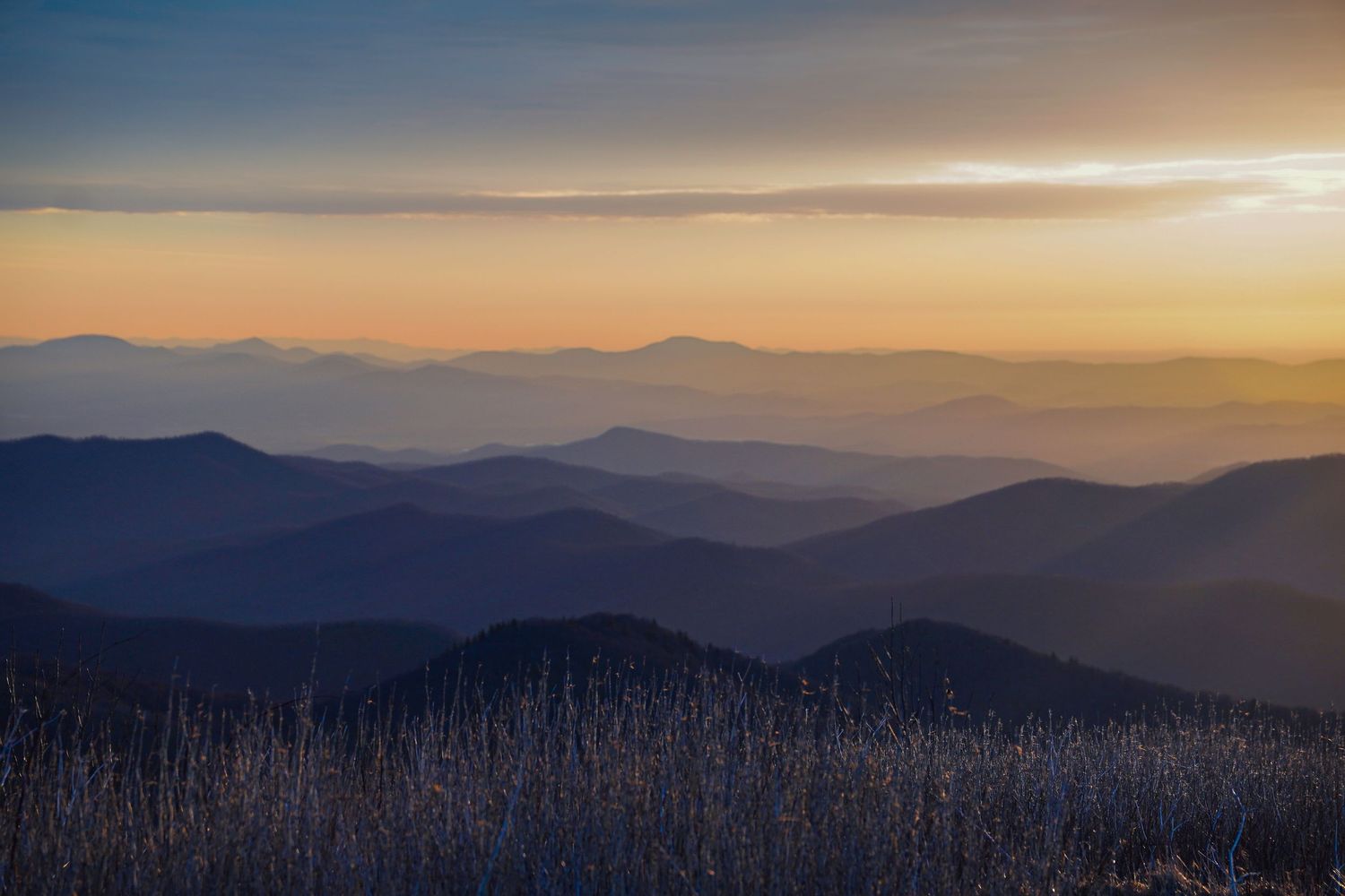
Black Balsam Knob at Dawn
South of Asheville
Mills River Overlook: Don't Forget to Turn Around
Mills River Overlook sits close enough to Asheville — roughly 20 minutes south — that you'll have more evidence of civilization in the landscape: more houses visible in the valley, more light pollution on the horizon if you're shooting pre-dawn. For photographers chasing pristine wilderness, that's a note worth having. For photographers who want a reliable, accessible sunrise location without a long drive, it still delivers.
What most people miss at Mills River: turn around. The view from the overlook faces one direction, but the sky behind you — back across the road, away from the main view — often catches gorgeous alpenglow in the minutes after sunrise. The light goes pink and lavender against the opposite ridgeline in a way that the designated overlook view completely misses. I've caught some of my best cloud inversions here, and I've watched dozens of photographers stand at the railing facing east while the best light of the morning played out directly behind them.
Best for: Accessible sunrise, cloud inversions, alpenglow (look behind you)
Crowd level: Moderate; close to Asheville means more drive-by visitors
Distance from Asheville: About 20 minutes
Buck Spring Gap Overlook at Mount Pisgah: Reliable but Busy
The Buck Spring Gap Overlook at the Mount Pisgah trailhead parking area (Milepost 407.7) is another bi-directional view — good for sunrise or sunset depending on what you're after. The view is narrower than some of the other locations here, hemmed in by the ridgeline on both sides, which gives it a different character: it's more of a focused, valley-floor shot than a panoramic one.
It's also frequently crowded, particularly because the Pisgah trailhead shares the parking area and hikers start arriving early. If you're here for sunrise, get there well before first light to secure a good position. The scene rewards patience more than some other spots — wait for the light to work its way down into the valley rather than rushing to leave once the sun crests.
Best for: Sunrise or sunset, valley views, accessible from Pisgah area
Crowd level: High, particularly when the trailhead is busy
Distance from Asheville: About 40 minutes
Cradle of Forestry Overlook: Winter Access Makes This One Special
The Cradle of Forestry Overlook, accessible from Highway 276, has something most Parkway overlooks can't offer: you can reach it in winter when the Parkway itself is closed. The road closes seasonally in many sections due to ice, but hiking in from 276 gives you Parkway-level views without Parkway-level road access requirements.
The overlook features a striking dead tree in the foreground — skeletal, sculptural, genuinely iconic — set against wide-angle views that work particularly well in winter when the deciduous trees are bare and the long distances open up. Cloud inversion potential here is strong, and the combination of the dead tree foreground against a fog-filled valley is one of those compositions that earns its keep in any portfolio.
Best for: Sunrise, winter access via Hwy 276, cloud inversions, wide-angle landscape
Crowd level: Lower than many overlooks, especially in shoulder season
Distance from Asheville: About 45 minutes
Pounding Mill Overlook: The One I Keep Coming Back To
If I had to pick a single overlook south of Asheville, I'd probably say Pounding Mill Overlook at Milepost 413.2 — and I'd say it without much hesitation.
Wide, open, long-range views. Generous parking. Strong cloud inversion potential. And the same winter-access advantage as Cradle of Forestry — you can hike in from Highway 276 when the Parkway is closed. What more do you want?
Here's the thing people don't immediately realize: Pounding Mill offers one of the best views of Looking Glass Rock in the entire area — better, somewhat ironically, than the actual Looking Glass Rock Overlook. The angle, the distance, the way the cliff face catches morning light — it works. If you've been to the dedicated overlook and left underwhelmed, come here instead.
In spring and early summer, wildflowers line the roadside heading south from the overlook. Add that to the standard sunrise toolkit and you have foreground options that most photographers aren't planning for.
Best for: Sunrise, cloud inversions, Looking Glass Rock views, winter access, wildflowers
Crowd level: Known spot but ample room to spread out
Distance from Asheville: About 55 minutes
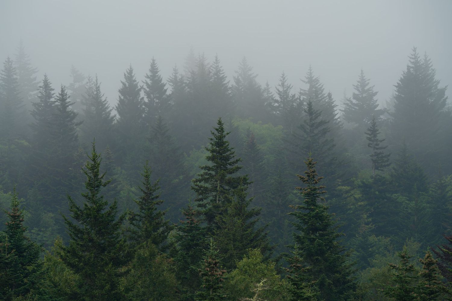
Evergreens near Devil's Courthouse
East Fork Overlook: Rhododendrons and Rolling Mountains
East Fork Overlook (Milepost 418.8) is a sunrise location I return to specifically in late spring and early summer, when the native rhododendrons and azaleas are in bloom along the roadside.
The view is a classic Blue Ridge composition: rolling mountain ridges receding into the distance, framed by the characteristic dark geometry of spruce and fir in the foreground. It photographs as a layered scene — foreground blooms, midground valley, background ridgeline — and the architectural evergreens on the far side of the valley give it a structure that holds up across different light conditions. Outside of bloom season it's still a solid sunrise location; in peak bloom, it's exceptional.
Best for: Sunrise, spring/early summer rhododendrons and azaleas, layered landscape compositions
Crowd level: Moderate
Distance from Asheville: About 60 minutes
Black Balsam Knob and the Art Loeb Trail: The One That Requires Effort and Gives Everything Back
I've photographed Black Balsam Knob more times than anywhere else on this list, and I'm not done with it. The reason is simple: 360-degree views from a grassy bald, essentially unlimited compositional options, and a hike that most people in reasonable shape can manage without technical gear.
The trailhead sits just off the Parkway on Black Balsam Road at Milepost 420.2. If you genuinely can't hike, there are a couple of scenic pull-offs on the road to the trailhead — one or two cars at a time — that offer views without the elevation gain. Use them. But if you can hike, don't stop there.
The summit of Black Balsam sits at about 6,214 feet and opens into one of those landscapes where you keep finding new compositions every time you move ten feet. Wide shots, intimate shots, dawn shots, dusk shots — it all works because the terrain itself is endlessly varied. Grassy balds, rocky outcroppings, distant ridgelines — you're not hunting for the one good angle because there are fifty of them.
If you want to leave the crowd behind entirely, keep going on the Art Loeb Trail toward Tennent Mountain. Most people turn around at Black Balsam. The hikers who make it to Tennent are rewarded with the kind of view that earns the extra miles: layer after layer of Blue Ridge ridgeline, several balds visible at once, and the intimate wildflower and windswept-grass compositions that define this part of the southern Appalachians.
Best for: Sunrise or sunset, 360-degree views, all-season photography, solitude at Tennent Mountain
Crowd level: Popular at Black Balsam summit; sparse at Tennent
Distance from Asheville: About 60–70 minutes
Devil's Courthouse Overlook: Evergreens Worth the Drive Alone
Devil's Courthouse (Milepost 422.4) doesn't announce itself the way Black Balsam does, and that's part of what I like about it.
From the overlook, you're looking directly at the rocky face of Devil's Courthouse itself — a dramatic granite outcropping that catches light in interesting ways throughout the day, not just at golden hour. The surrounding evergreens on this stretch of Parkway are worth mentioning on their own: the density, the geometry, the way they line the road and frame the views are characteristic of this particular elevation, and they photograph beautifully.
The view from the overlook is narrower than the wide-open balds, which makes it a different kind of challenge. You're working with a more defined, framed scene rather than an open horizon. For photographers who like compositional constraint, this is actually a feature.
A short, steep hike to the summit of Devil's Courthouse — about 0.9 miles round trip — opens up an entirely different view. If panoramic grandeur is what you're after, hike to the top. The overlook itself is worth the stop regardless; the summit rewards those who make it.
Best for: Evergreen forest compositions, dramatic rock face photography, summit panoramas
Crowd level: Lighter than Black Balsam, modest at the overlook
Distance from Asheville: About 70 minutes
Waterrock Knob Overlook: A Worthy Detour Through Waynesville
Waterrock Knob (Milepost 451.2) sits about 90 minutes from Asheville, which means the most practical route takes you through Waynesville rather than straight down the Parkway — worth knowing before you set your GPS. It's the furthest location on this list, but it earns the drive.
The overlook itself delivers sunrise and sunset views that hold up against anything closer to Asheville, and in late spring and early summer, rhododendrons bloom in the surrounding area and add exactly the kind of pink foreground color that makes a mountain overlook photograph sing. Even without bloom season, the expansive views from the parking area alone are satisfying — I've spent plenty of mornings here without ever setting foot on the trail and left happy with what I captured.
There is a trail to a higher viewpoint if you want to add elevation and a different perspective. Most of the time, though, the parking lot offers enough compositional options that the hike feels optional rather than necessary.
One practical note worth mentioning here, and at Craggy Overlook as well: both locations have restroom facilities, which is a genuine luxury on the Parkway. Both are also subject to seasonal closures, so don't count on them in the off-season without checking first.
Best for: Sunrise, sunset, rhododendron season (late spring/early summer), optional summit hike
Crowd level: Moderate; less trafficked than locations closer to Asheville
Distance from Asheville: About 90 minutes via Waynesville
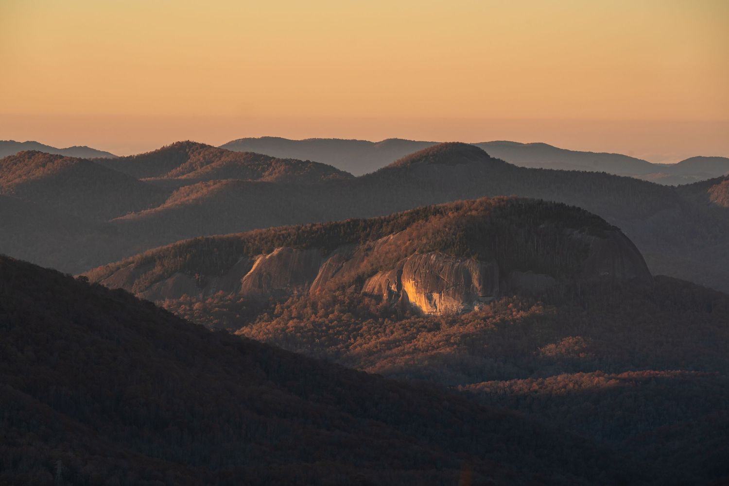
Looking Glass Rock
Frequently Asked Questions
What is the best overlook on the Blue Ridge Parkway near Asheville for photography? The answer depends on what you're after, but Pounding Mill Overlook and Black Balsam Knob consistently produce the strongest images. Pounding Mill offers wide, accessible views with great cloud inversion potential and winter access via Highway 276. Black Balsam rewards the hike with 360-degree views and essentially unlimited compositional options. For a quick, accessible sunrise close to Asheville, Craggy Overlook is hard to beat.
Is the Blue Ridge Parkway currently open near Asheville? As of 2025, sections of the Parkway north of Asheville remain closed due to Hurricane Helene damage, with portions expected to reopen in 2027. The sections south of Asheville — including Pisgah, Black Balsam, and Devil's Courthouse — are generally accessible. Always check the NPS Blue Ridge Parkway road conditions page before your visit, as closures can also occur in winter due to ice.
What time should I arrive at a Blue Ridge Parkway overlook for sunrise? Arrive 30 to 45 minutes before the listed sunrise time. The most useful light on the Parkway often comes in the 15 to 20 minutes before the sun clears the ridge, when the sky is warm and diffuse and the shadows are still long. Arriving at sunrise means you've already missed the best of it.
Can I access Blue Ridge Parkway overlooks in winter when the road is closed? Yes — several of the best photography locations are accessible year-round by hiking in from Highway 276, including Pounding Mill Overlook and Cradle of Forestry Overlook. Winter access can be worth the extra effort: fewer people, bare trees that open up long-distance views, and the possibility of snow or ice that transforms familiar compositions entirely.
Getting Out There
The Blue Ridge Parkway within 90 minutes of Asheville holds enough material for a lifetime of photography — and I mean that without exaggeration. Every season changes every location. Every weather system creates conditions you haven't seen before. The photographers who get the best images from this road aren't necessarily the ones with the best gear; they're the ones who show up repeatedly, in shoulder seasons, before dawn, in questionable weather, and who know their locations well enough to read the light as it develops.
This guide is a starting point, not a final word. Get out there, shoot the obvious spots, then start looking for the less obvious ones. The Parkway rewards that kind of attention.